and value your legacy.


in value.

I'm a landowner.
Can I use BUPi to
identify my properties?
identify my properties?
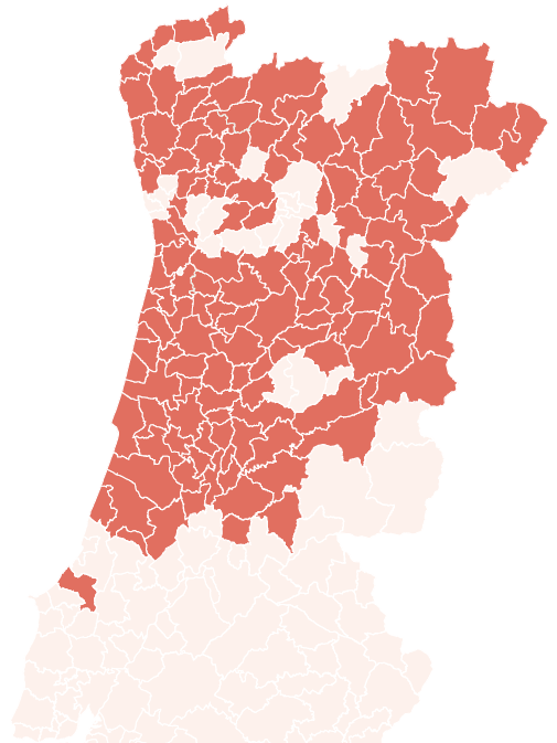
Check here the list of municipalities where BUPi is already available.


Yes!
You can now quickly locate your
properties in that municipality.
Not yet
The municipality you selected has not yet joined BUPi or is in the process of joining. Check our website regularly and be the first to know when this process begins.
Last update: dd/mm/aaaa
The municipality you selected already has a land registry. You will soon be able to register your lands for free. Check this page and our website regularly and be the first to know when this process begins.
Last update: dd/mm/aaaa
The municipality you selected already has land registry of rural properties but the existing elements are not yet vectorized. You can register for free soon. Check this page and our website regularly and be the first to know when this process begins.
Last update: dd/mm/aaaa
See the information available here:
What is BUPi
BUPi (Digital Land Registry) is a platform aimed at landowners, which allows mapping, understanding and valuing the Portuguese territory, in a simple and free way. It started in 2017 as a pilot project in 10 Municipalities. After its success, it is now being expanded to the whole country.

I’M A LANDOWNER
Why is it important to register my
properties? And how can I do it?
properties? And how can I do it?
Land registration protects
what’s yours
what’s yours
Your rights as landowner are only guaranteed with the registration of your land at the land registry office. Having properties registered at the Portuguese Tax and Customs Authority does not guarantee their ownership. For the registry process to be free, you must present the geolocation of your property, by designing its boundaries before filling and oficially submitting the registration petition.
THE PROPERTY IS
REGISTERED IN THE
LAND REGISTRY OFFICE
REGISTERED IN THE
LAND REGISTRY OFFICE
THROUGH BUPi,
THE REGISTRATION PROCESS
IS FREE
THE REGISTRATION PROCESS
IS FREE
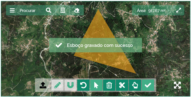
Identify here or
at a counter
at a counter
Even those who have their properties registered must complement this information with the identification of the property boundaries on the online platform or, alternatively, in person at a BUPi’s service counter.

With your contribution, our joint knowledge of the country will increase.

Municipalities with BUPi
out of 153 joining

(-7%)
Georeferenced descriptions
(RGG) started this month
Active Qualified
BUPi Technician
Total Number of Georeferenced descriptions (RGG)
Top 5 Municipalities per
number of RGGs in junho:
number of RGGs in junho:
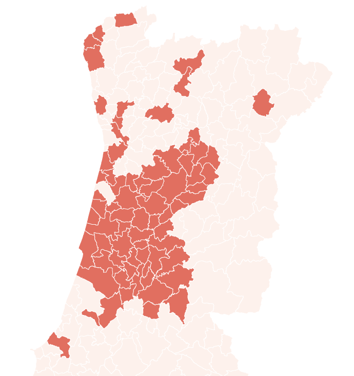
Declared georeferenced descriptions:
- RGG's (120.485 ha)
- Agricultural plots (798.636 ha)
- Forest Exploitation (465.163 ha)
- Large Landowners (3.704 ha)
- Property sketch (1.577 ha)
- Common Land (64.034 ha)
Total known area:
1.829.783 (ha)
Last update: 04-07-2022
AUGUST REAL-TIME NUMBERS
REAL-TIME NUMBERS
With your contribution, our joint knowledge of the country will increase.
72
MUNICIPALITIES IN THE BUPi
OF 141 JOINING
OF 141 JOINING
677.865
REGISTERED PROPERTIES
Last update: 30-08-2021
BUPi Indicators
Keep up with all the news
Subscribe to our newsletter
Subscribe to the newsletter and get to know, first hand, when new municipalities join BUPi.
Receive regularly the latest news regarding the project’s evolution.


